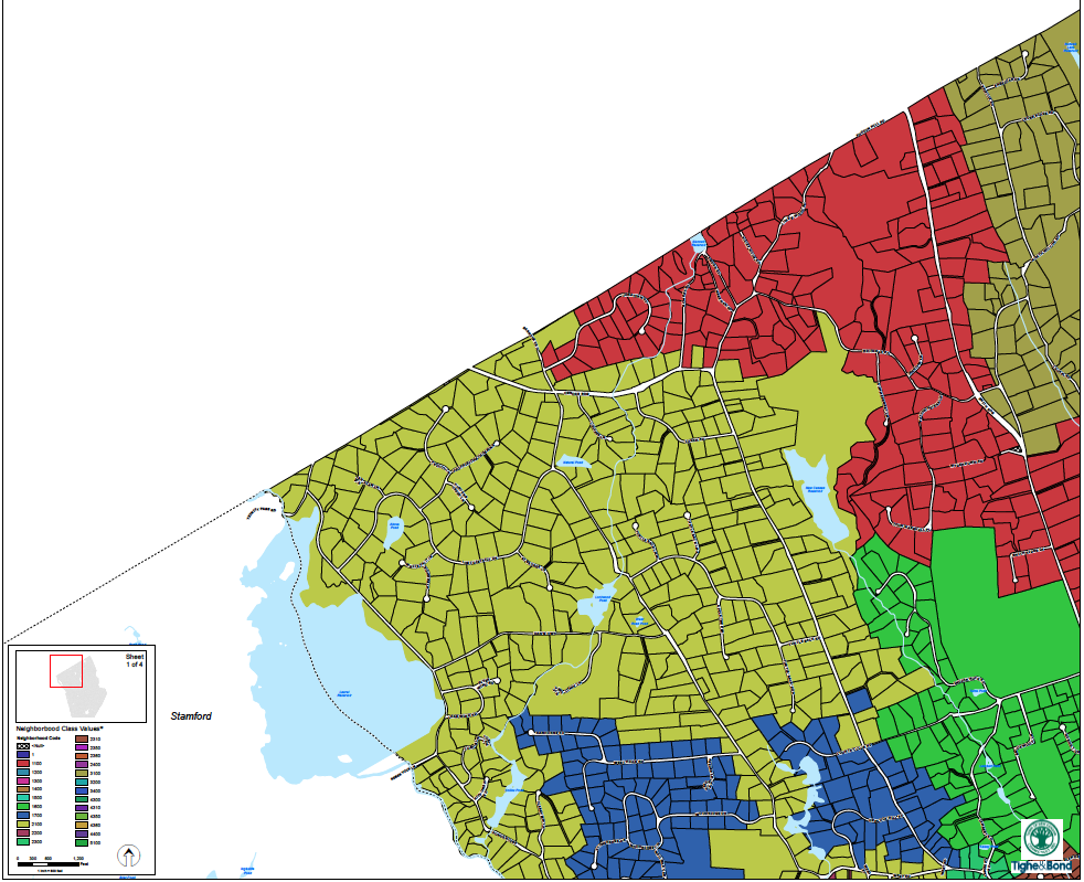
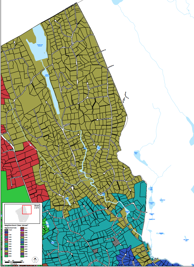
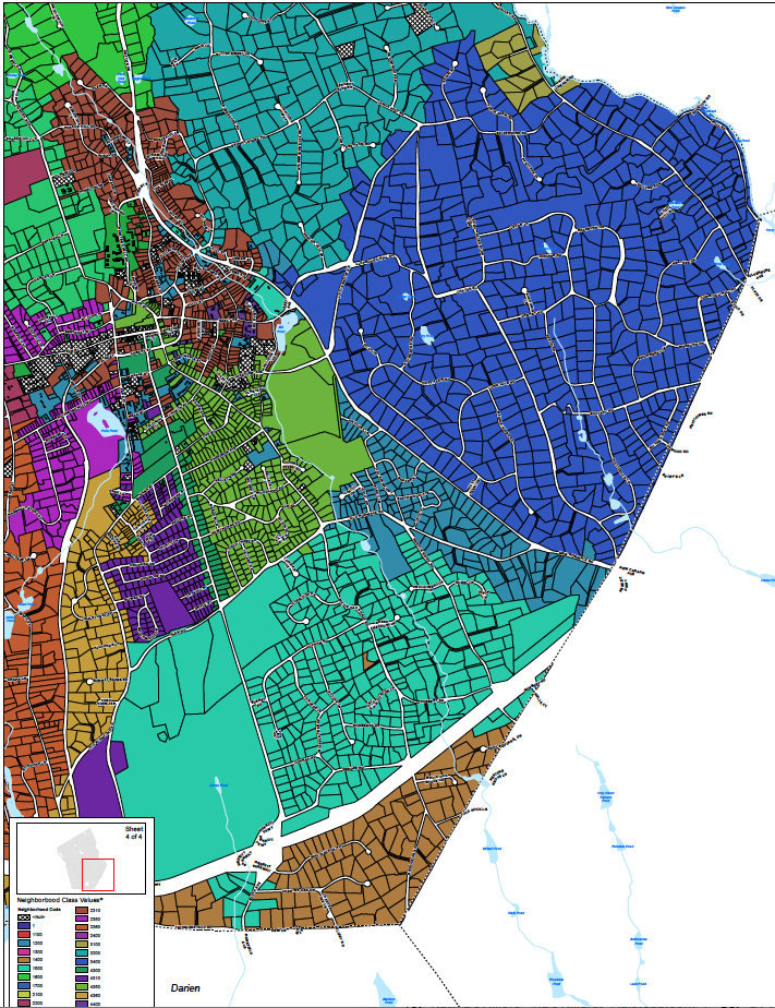
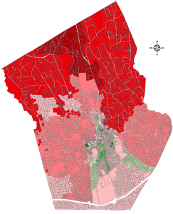
This is the heat map produced by Tighe & Bond for the Town of New Canaan as part of their most recent revaluation, October 2018. (Email me for the original PDF which will allow you to zoom into a particular property.)
My purpose in uploading this map is because it should be a public document and a tool for decision-making. Homeowners, their realtors, town officials and elected leaders need to understand which parts of our town are experiencing the greatest changes in valuation if we are going to debate why the changes are occurring and whether we want to use the tools available (zoning regulations, ordinances, the TEDAC) to make changes.
- Why was the area immediately north of the country club affected more than any other?
- Does lack of cell service affect value? Does proximity to town or to the Talmade Hill station?
- East and West school districts look to be affected equally, and more so than the South school district
- Prides Crossing, Hatfield Mews and 10 other properties stand out with more than 10% gains. Why?
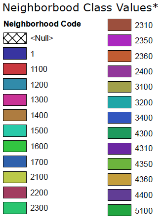
The following chart provided in the revaluation presentation references 23 different neighborhoods in New Canaan. But, there was no corresponding chart showing which neighborhood is which.
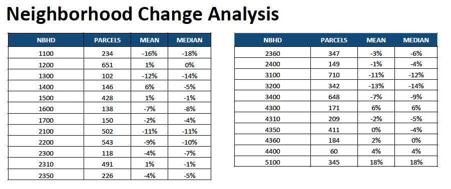
Here are the original neighborhood maps from Tighe & Bond provided to New Canaan around 2000. They may have been updated since that time but nobody seems to have a more updated copy.